
Zion & Bryce Canyon: Audio Driving Tour
2/10
2 out of 10Features
- 1d
- Mobile voucher
- Instant confirmation
Overview
The GuideAlong Audio Driving Tour takes you on an incredible journey through two of America’s most popular national parks.
Along the way you'll be guided to all of the area's famous highlights as well as lessor known gems including bucket-list hikes, a historic ghost town, and a top lookout across the entire Bryce Amphitheater.
This self-guided audio tour helps you discover more on your road trip with fascinating behind-the-scenes stories, local tips and directions that plays automatically along the drive.
Enjoy the freedom to explore offline at your own pace so you can spend more time at places that interest you, and bypass any that don’t.
✅ Stories, tips and directions play automatically based on your location
✅ Travel at your own pace
✅ Tour offline using GPS, no cell service or WiFi needed
✅ Suggested itineraries for half, full or multi day use
✅ No time limits or expiry, free updates
Activity location
- Grafton Cemetary
- 250 S, Grafton
- 84767, Rockville, Utah, United States
Meeting/Redemption Point
- La Verkin
- La Verkin, Utah, United States
Check availability
Zion & Bryce Canyon: Audio Driving Tour in English
- 1d
- Opening hours: Mon 12:00am-11:59pm
- English
What's included, what's not
- Support: Toll free phone, chat and email
- Easy To Use: Pre-download and tour offline
- Trip Planners: In-app, web and PDF
- GuideAlong (GyPSy Guide) Audio Tour: 195+ Points
- One-Time Purchase: No time or date use limit or expiry
- Location Based: Stories, tips & directions that autoplay
- Flexible Routes: Suggested itineraries or create your own
- Entrance Fees
- National Park Passes
- Reservations
Know before you book
- Suitable for all physical fitness levels
Activity itinerary
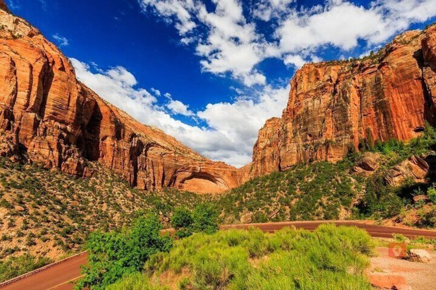
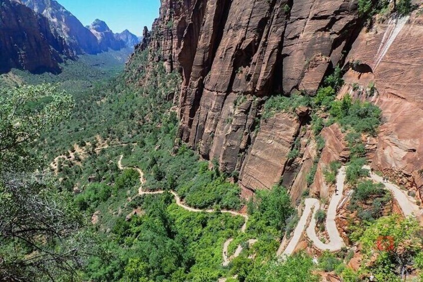
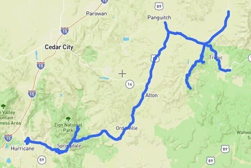
Zion National Park
- 8h
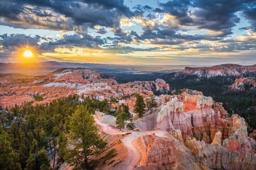
Bryce Canyon National Park
- 6h
Inspiration Point
- 20m
Sunset Point
- 20m
Bryce Canyon Scenic Drive (Pass by)
Bryce Point
- 20m
Emerald Pools
- 1h
Grafton Cemetary
- 30m
Checkerboard Mesa
- 20m
Zion-Mt. Carmel Tunnel (Pass by)
Springdale
- 1h
The Narrows
- 2h
Weeping Rock Trail
- 30m
Red Canyon (Pass by)
Grotto Trail
- 30m
Sunrise Point
- 20m
Location
Activity location
- Grafton Cemetary
- 250 S, Grafton
- 84767, Rockville, Utah, United States
Meeting/Redemption Point
- La Verkin
- La Verkin, Utah, United States